|
|
||
|
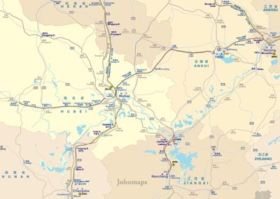
Hubei (Chinese: 湖北; pinyin: About this sound Húběi; Wade–Giles: Hu-pei; Postal map spelling: Hupeh) is a province of the People's
Republic of China, located in the easternmost part of Central China. The name of the province means "north of the lake", referring
to its position north of Lake Dongting.[3] The provincial capital is Wuhan, a major transportation thoroughfare and the political,
cultural, and economic hub of Central China.
Hubei is officially abbreviated to "鄂" (È), an ancient name associated with the eastern part of the province since the Qin dynasty,
while a popular name for Hubei is "楚" (Chǔ), after the powerful state of Chu that existed here during the Eastern Zhou dynasty.
It borders Henan to the north, Anhui to the east, Jiangxi to the southeast, Hunan to the south, Chongqing to the west, and Shaanxi
to the northwest. The high-profile Three Gorges Dam is located at Yichang, in the west of the province.
|
||