Guangzhou, China

Local News | Weather | Airport
(All External Links)


Maps of Guangzhou

Subway Map of Guangzhou

Click to see full sized-map

JohoMaps! 2005


Metro Map of Guangzhou
  Date:   Dec, 2006 (3rd Ed)
Map format:   jpeg
Dimension:   1049 x 707 pixels (318 kb)
Copyright holder:   Johomaps!
Conditions of using this map:   All rights reserved.  Contact for permission
Computer Specifics:   Prepared using Adobe Illustrator


[Map Links]


Real Time Guangzhou Travel Info

Weather Now
Click for Guangzhou, China Forecast


Exchange


Current Time


City Info

Other names of Guangzhou:
Canton (Old name)

Guangzhou (From Wikipedia)
Copyright owned by wikipedia.org
See here for copyright and licensing conditions


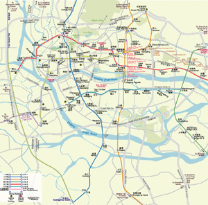
Guangzhou is the capital of Guangdong Province in southern China. The city was formerly known internationally as Canton City or simply Canton, after a French language transliteration of the city name in Cantonese. It is a port on the Pearl River, which is navigable to the South China Sea. As of the 2000 census, the city population was 9.94 million making it the most populous city in the province and the fifth most populous in China.

The Chinese abbreviation of Guangzhou is Sui (穗; pinyin: sùi; Jyutping: seoi6; Yale: seuīh) or sometimes GZ. This city has the nicknames of Wuyangcheng (city of five rams), Yangcheng (city of rams), Huacheng (city of flowers), or Suicheng. The city can also be refered to as the WuMengCheng (City of Wood Wools), a reference to a tall, native tree that produces wool fiber in its gorgeous red blossoms.

"Canton" was the convenient French romanisation for Europeans who during the colonial period generally did not understand ideographic characters (see exonym and endonym). When the term "Canton" is pronounced in French it provides a closer oral rendering of the name in its original Cantonese. Guangzhou is a Mandarin pronunciation of the Han ideographs.

[Read full article]


Interactive Maps (with Rating by Johomaps *) - External Links

Baidu.com (Chinese Only) General Rating:
  • Interface is very similar to Google Maps
  • Click on the orange squares, they represent major metropolitan areas where detailed street maps are available.
  • Very detailed mapping for the country side including names of many small villages
  • Subway routes included for major cities, but stations are not shown.
  • Accurate highway information but some projection errors are found in known areas.
  • User-friendliness: 4/5
  • Printer-friendliness: 4/5 (Use the print command on the top right hand corner)
Required Program None
Orthophoto  
Road Names and Highway Numbers
Additional Info N/A


Mapabc.com (Chinese Only) General Rating:
  • First Interactive Maps of China
  • Accurate information on streets and highways of most major cities in China.  Relative lack of information on rural areas.  As many other maps of China, it has difficulties catching up with the extreme speed of infrastructure construction. Some erroneous information on roads, for instance, a few highways are not actually highways.
  • Select city, province or regions in the middle column and go from there.
  • The Zoom tool is on the right margin of the map window.
  • User-friendliness: 3/5
  • Printer-friendliness: 4/5
Required Program Java Applet
Orthophoto  
Road Names and Highway Numbers (no hwy numbers)
Additional Info N/A

Reference Maps  - External Links


Map and info of Guangzhou's Subway System (Urban Rail. net)
Maps and the most updated info on the subway system of Guangzhou


Google Sat Photo
 
  • Map not available yet, satellite photo only
Required Program No
Orthophoto  
Road names and highway numbers
Additional Info N/A


* Ratings are based solely on opinions of our map reviewers.  Financial support and benefits to the web site have no influence on the ratings.