|
İstanbul, Turkey |
Local
News | Weather
| Airports: Ataturk Airport,
|
|
Maps of İstanbul |
|
|
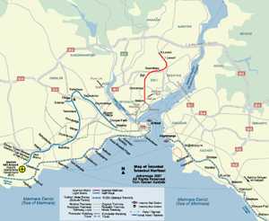
Metro Map of İstanbul | |||
| Date: | Aug, 2007 | |||
| Map format: | jpeg | |||
| Dimension: | 940 x 770 pixels (509 kb) | |||
| Copyright holder: | Johomaps! | |||
| Conditions of using this map: | All rights reserved | |||
| Computer Specifics: | Prepared using Adobe Illustrator | |||
|
|
||||
|
Real Time Istanbul Travel Info |
||
|
Weather Now |
||

|
City Info |
İstanbul (From Wikipedia) Istanbul (Turkish: İstanbul, Greek: Κωνσταντινούπολη, historically Byzantium and later Constantinople) is Turkey's most populous city, and its cultural and financial center. The city covers 25 districts of the Istanbul province. It is located at 41?N 29?E, on the Bosphorus strait, and encompasses the natural harbor known as the Golden Horn, in the northwest of the country. It extends both on the European (Thrace) and on the Asian (Anatolia) side of the Bosphorus, and is thereby the only metropolis in the world which is situated on two continents. In its long history, Istanbul (Constantinople) served as the capital city of the Roman Empire (330-395), the Byzantine Empire (395-1204 and 1261-1453), the Latin Empire (1204-1261), and the Ottoman Empire (1453-1922). The city was chosen as joint European Capital of Culture for 2010. The "Historic Areas of Istanbul" were added to the UNESCO World Heritage List in 1985. |