|
Maps of the Alps |
|
|
|
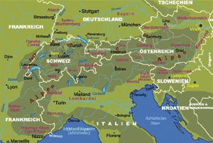
Physical Map of Switzerland, Germany, and Austria
(English, French, German, and Italian) |
||
| Date: | Jan, 2006 (2nd Ed) | |||
| Map format: | gif | |||
| Dimension: | 657 x 442 pixels (100 kb) | |||
| Copyright holder: | Johomaps! | |||
| Conditions of using this map: | Unlimited educational use, free download. Free web posting with web link to www.johomaps.com | |||
| Computer Specifics: | Prepared using Adobe Illustrator and Photoshop | |||
|
Real Time Alps Travel Info |
||||
|
|
Regional News:
|
|||
Web Maps (with Rating by Johomaps *)
| Rail
Map of Europe for Austria
Rail Map of Europe for Switzerland by Raileurope.com |
General
Rating: |
|
Click view map button
|
Required Program | No |
| Orthophoto | ||
| Road names and highway numbers | ||
| Additional Info | Major stations and railway routes, country by country | |
Reference Maps - External Links
| Oblique view of DEM with Satellite Photo of the Alps (WorldSat) | |
| DEM is Digital Elevation Model, it enables you to see a bird's eye view of the relief. The second image is more useful because the Mediterranean Sea is visible as a reference (The blue corner on the lower right). You are looking towards the northeast. |
|
* Ratings are based solely on opinions of our map reviewers. Financial support and benefits to the web site have no influence on the ratings. |