Paris,

 France


Local News | Weather | Airports
(All External Links)


Maps of Paris

Plan de Paris / City Map of Paris

Click to see full sized-map

JohoMaps! 2005-06


City Map of Paris
  Date:   Sep, 2005 (2nd Ed)
Map format:   jpeg
Dimension:   1065 x 928 pixels (1.28 mb)
Copyright holder:   Johomaps!
Conditions of using this map:   Unlimited educational use, free download.  Free web posting with web link to www.johomaps.com
Computer Specifics:   Prepared using Adobe Illustrator


Carte du Metro de Paris / Metro Map of Paris

Click to see full sized-map

JohoMaps! 2006


Interactive
Metro Map of Paris
  Date:   Sep, 2006
Map format:   jpeg
Dimension:   917 x 850 pixels (908 kb)
Copyright holder:   Johomaps!
Conditions of using this map:   All rights reserved.  Contact for permission
Computer Specifics:   Prepared using Adobe Illustrator


Carte du Metro de Paris / Metro Map of Paris

Click to see full sized-map

JohoMaps! 2006


Interactive
Region Map of Paris (Geographic)
  Date:   Sep, 2006
Map format:   jpeg
Dimension:   918 x 799 pixels (1.28 mb)
Copyright holder:   Johomaps!
Conditions of using this map:   All rights reserved.  Contact for permission
Computer Specifics:   Prepared using Adobe Illustrator
   
   
[Map Links]

Real Time Paris Travel Info

Weather Now
Click for Paris, France Forecast


Exchange


Current Time

 
Paris Airports Info


City Info

Adjective:
Parisien / Parisienne (French)
Parisian (English)

Paris (From Wikipedia)
Copyright owned by wikipedia.org
See here for copyright and licensing conditions

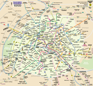
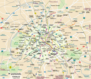
Paris is the capital city of France and a French département. Situated on the banks of the river Seine in north-central France, it is also the capital of the Île-de-France région (also known as "Paris Region"), which encompasses Paris and its suburbs. Paris had an estimated mid-2004 population of 2,144,700. The Paris urban area, extending well beyond the city boundaries, has today an estimated population of 9.93 million. The Paris metropolitan area (including satellite towns) stood at 11.5 million in 1999 and is one of the most populated metropolitan areas in Europe.

The Paris Region is France's most dynamic centre of economic activity. It produces more than a quarter of France's wealth, with a GDP of €478.7 billion (US$595.3 billion) in 2005.  With La Défense, one of the largest business districts in Europe, the Paris urban area (unité urbaine) also hosts the head offices of almost half of the major French companies, as well as the offices of major international firms. Paris is a leading global cultural, business and political centre and has a major international influence in fashion, gastronomy and the arts. It is widely regarded as one of the world's major global cities, with the headquarters of international organisations such as UNESCO, the OECD, the ICC, or the informal Paris Club.

The city, which is renowned for its defining neo-classical architecture, hosts many museums and galleries and has an active nightlife. The most recognisable symbol of Paris is the 324 metre (1,063 ft) Eiffel Tower on the banks of the Seine. Dubbed "the City of Light" (la Ville Lumière) since the 19th century, Paris is regarded by some as one of the most romantic cities in the world. It is also the most visited city in the world, with more than 30 million visitors per year.

[See full article


Web Maps (with Rating by Johomaps *) - External Links


Paris Balades General Rating:
  • A simple map of Paris that lets you click to one of the 20 districts (arrondisments) of Paris, as well as a few important districts outside the city (like La Défense)  
  • Detailed descriptions of many important buildings and attractions
  • User-friendliness: 3.5/5
  • Printer-friendliness: 1/5
  • Special Features: Detailed description on each district.  Not the traditional zoom in zoom out function.  District by district is more user-friendly because it is hard to figure out where you are looking at with traditional zoom in zoom out function.
  • The detailed map (of each arrondisments) is put in a framed page, and the map frame is too small.  However, you can resize the frame by dragging it.  Do so!
Required Program None
Orthophoto (Date: 2002)
Road Names and Highway Numbers (no hwy numbers)
Additional Info N/A


Google Maps
  • High Definition satellite photo
  • User-friendliness: 4/5
  • Printer-friendliness: 4/5
  • Special Features: Hybrid Maps, i.e., highway info projected on satellite images.  Images are scaled and projections are very accurate
  • Good zoom in and zoom out function
  • Detailed info only appears at appropriate levels to avoid cluttering the map.
Required Program N/A
Orthophoto
Road Names and Highway Numbers


Reference Maps and Info  - External Links


Map and info of Métro System of Paris (Urban Rail. net)
Maps and the most updated info on the subway (métrpolitaine) of Paris


* Ratings are based solely on opinions of our map reviewers.  Financial support and benefits to the web site have no influence on the ratings.