|
Maps of Germany, Belgium, Netherlands, and Luxemburg |
|
Maps of Germany, Belgium, Netherlands, and Luxemburg |
|
|
ˇˇ |
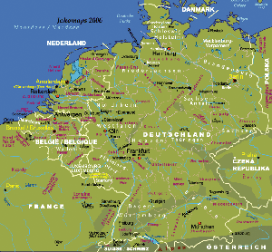
Physical Map of Germany, and Benelux
(English and Local Languages) |
||
| ˇˇ | Date: | ˇˇ | Jan, 2006 (2nd Ed) | |
| Map format: | gif | |||
| Dimension: | 683 x 633 pixels (138 kb) | |||
| Copyright holder: | Johomaps! | |||
| Conditions of using this map: | Unlimited educational use, free download. Free web posting with web link to www.johomaps.com | |||
| Computer Specifics: | Prepared using Adobe Illustrator and Photoshop | |||
|
|
||||
|
Real Time Regional Travel Info |
|||
|
ˇˇ |
National News Networks:
|
||
Web Maps (with Rating by Johomaps *)
| Rail
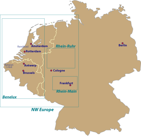
Map of Europe for Benelux
Rail Map of Europe for Germany by Raileurope.com |
General
Rating: |
|
Click view map button
|
Required Program | No |
| Orthophoto | ||
| Road names and highway numbers | ||
| Additional Info | Major stations and railway routes, country by country | |
|
* Ratings are based solely on opinions of our map reviewers. Financial support and benefits to the web site have no influence on the ratings. |
![]()
![]()