|
|
||||
|
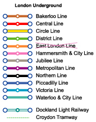
Note: Only selected stations are
shown on this map.
Channel Tunnel Rail Link
stations opened in Nov, 07
World > Europe > Ireland and UK > London > London Urban Rail Map |
||||
|
|
||||
|
|
Last Updated: Nov 08, 2009 London Map Series: [London Metro Map] [London Railway Map] [London Network Map] [London Highway Map]
Greater London Urban Rail Info Note: The National Railway Network is served by many train companies. Some trains do not stop at each station. The terminus for suburban and interurban trains are (clockwise from the north):
|
|||
| Euston | Northern, and Victoria Lines | |||
| King's Cross | Hammersmith and City, Metropolitan, Northern, Piccadilly, and Victoria Lines | |||
| St. Pancras | Hammersmith and City, Metropolitan, Northern, Piccadilly, and Victoria Lines | |||
| Liverpool Street | Circle, Hammersmith & City, and Metropolitan Lines | |||
| Fenchchurch St | No Underground Connection. Closest stations: Algate (Circle, Metropolitan Lines), Tower Hill (Circle, District Lines) and Tower Gate (Dockland Light Rail) | |||
| Canon Street | Circle, and District Lines | |||
| Blackfriars | Circle, and District Lines | |||
| Charing Cross | Bakerloo, and Northern Lines | |||
| Waterloo | Bakerloo, Jubilee, and Northern Lines | |||
| Victoria | Circle, District, and Victoria Lines | |||
| Paddington | Bakerloo, Circle, District, and Hammersmith & City Lines | |||
| Marylebone | Bakerloo Line | |||
|
Direct Airport to London Connection
Other Airport Rail Services
|
||||


|
Embed the most updated version of this map on your site. No permission needed.
|
![]()
![]()