| Hydrology of Burns Bog
|
||
Water bodies and drainage |
||
|
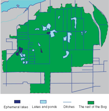
There are many water bodies in Burns Bog. This map shows some of the larger lakes, and ditches. If you are flying above Burns Bog in the winter times, you will find this map of water bodies very inaccurate. Many small ephemeral lakes and ponds in the Bog do not appear on this map. That is because of the fact that this map only depict the Bog in the dry season. In fact, most maps of the region are drafted with the help of aerial photographs obtained during the summer. |
 |
|
|
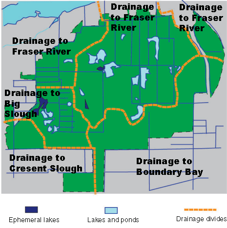
Burns Bog is elevated in the middle and slopes gently to the edge. Consequently, water drains outwards away from the centre. This map illustrates the identifiable drainage basins in Burns Bog. These boundaries are hard to be identified with certainty because water flows extremely slowly in the Bog, and the drainage pattern is further complicated by a series of ditches which cross drainage basin boundaries. |
 |
|
|
|
||