|
|
|
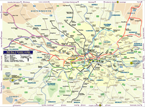
London Metro Map
(Linked to Google Maps) |
||
| Date: | Oct, 2010 (7th Ed) | |||
| Map format: | jpeg | |||
| Dimension: | 1056 x 718 pixels (968 kb) | |||
| Copyright holder: | Johomaps! | |||
| Conditions of using this map: |
All rights reserved. Contact
|
|||
| Computer Specifics: | Prepared using Adobe Illustrator | |||
|
|
||||
|
|
|
London Metro Map (Linked to Wikipedia) |
||
| Date: | Oct, 2010 (7th Ed) | |||
| Map format: | jpeg | |||
| Dimension: | 1056 x 718 pixels (968 kb) | |||
| Copyright holder: | Johomaps! | |||
| Conditions of using this map: |
All rights reserved. Contact
|
|||
| Computer Specifics: | Prepared using Adobe Illustrator | |||
|
|
|
London Urban Rail Map
(Geographically Correct) |
||
| Date: | Oct, 2010 (6th Ed) | |||
| Map format: | jpeg | |||
| Dimension: | 1022 x 754 pixels (790 kb) | |||
| Copyright holder: | Johomaps! | |||
| Conditions of using this map: |
All rights reserved. Contact
|
|||
| Computer Specifics: | Prepared using Adobe Illustrator | |||
|
|
|
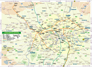
Regional Rail Network of London | ||
| Date: | Oct, 2010 (2nd Ed) | |||
| Map format: | jpeg | |||
| Dimension: | 1022 x 754 pixels (885 kb) | |||
| Copyright holder: | Johomaps! | |||
| Conditions of using this map: |
All rights reserved. Contact
|
|||
| Computer Specifics: | Prepared using Adobe Illustrator | |||
|
|
|
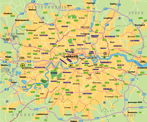
Map of London | ||
| Date: | Aug, 2006 (2nd Ed) | |||
| Map format: | jpeg | |||
| Dimension: | 881 x 732 pixels (179 kb) | |||
| Copyright holder: | Johomaps! | |||
| Conditions of using this map: | Unlimited educational use, free download. Free web posting with web link to www.johomaps.com | |||
| Computer Specifics: | Prepared using Adobe Illustrator | |||