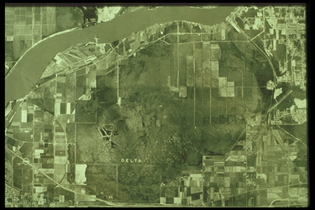
This is an aerial photograph composite of Burns Bog. The images were taken in the 1970's (est.). The exact date when the image was taken is unknown. It is also unknown whether the images were corrected for errors (orthorectification). This image composite shows a clear distinction between harvested areas and serene areas. Areas with light colour strips and patches had been mined. Those areas are accessed by roads or railways, which are shown as narrow and straight lines. The southern portion had not been harvested, which are discernable by the small bright spots. Click to enlarge.