| Aerial photographs of Burns Bog
|
||
Burns Bog from the air |
||
|
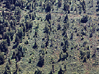
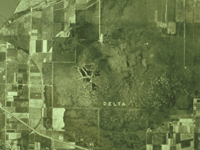
This is the eastern portion of Burns Bog. The grid pattern is very apparent. Many people have the impression that Burns Bog is a serene wilderness. In fact, the bog was unfortunately disturbed by humans in many aspects and less than 20% of the Bog is relatively undisturbed. Peat harvesting took place across the Bog from east to west. In the eastern portion , the ditches which were installed by the peat harvesters continue to prevent a natural bog-like condition to return. |
|
|
|
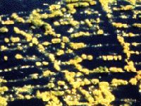
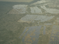
Water bodies are frequent throughout the Bog. Natural lakes occur in Burns Bog but most water bodies we see today are artificial. Almost all of these lakes are shallow depressions created by peat harvesting. Due to the fact that many of these lakes become dry in the dry season, the lake boundaries are constantly changing. it is difficult to represent things with changing boundaries on a map. Most of the aerial photographs and satellite images of our region are taken in the dry season when the sky is more likely to be clear. This makes it difficult to look at the full extent of lakes and other water bodies in the Bog. For instance, the two images below show the summer extent of lakes when most water bodies in the middle of the Bog is dry. As a result of the wet season time gap and the mapping difficulties, most water bodies in Burns Bog are omitted on regional maps. |
|
|
|
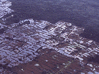
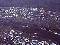
Aerial photograph showing Burns Bog and the surrounding. When this image was taken, the urban areas of North Delta and Surrey are still rural. The City of Vancouver Landfill and Highway 91 did not exist. |
|
|
|
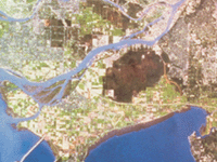
A peculiar dark green spot on a satellite image of the Fraser Delta often puzzled many people who do not know the region well. The spot is Burns Bog. It stands in great contrast with the surrounding gray and light green, which are urban and farmlands respectively. |
|
|