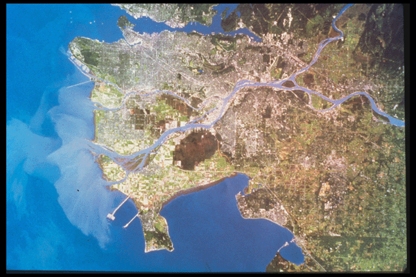
This is a real colour satellite image of the Greater Vancouver region. Burns Bog has shrunk significantly since this image was taken. The infringement occurs mainly on the southern edge by the City of Vancouver Landfill. The garbage dump appears as a bright white patch on the image near the southwest corner of the Bog. The landfill is much bigger if you look at the most recent aerial photograph. Click to enlarge the image.