|
|
|||
| World > North America > Canada > BC > Vancouver > Indian Arm | |||
|
[Back to Indian Arm Main Page]
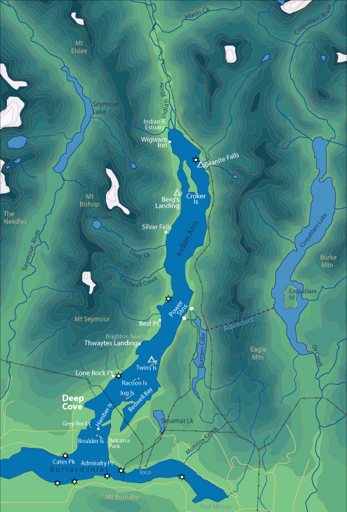
Admiralty Point | Bedwell Bay |
Belcarra |
Best Point
| Bishop |
Cates Park Distance from Deep Cove: 2.5 km Paddling Time One Way: Fast: 35 min. Avg: 50 min. Leisurely: 1 hr 20 min. Suggested Route: Paddle South from Deep Cove along the west shore of Lower Indian Arm. Hazards: West of Roche Point there is a public boat launch, hence an increase of motorboat traffic. Currents in this area are the strongest in Indian Arm at 1-knot max. Once rounding Roche Point you enter Burrard Inlet where the currents will increase as you approach the 2nd Narrows Bridge. This area is extremely dangerous with tidal currents of 5- 6 knots in the narrows. Strong afternoon winds blow from the west up Burrard Inlet. Paddling is prohibited between 2nd Narrows Bridge and Lions Gate Bridge, as it is a working harbour with lots of freighter traffic. Features: Grass area, beach, dock, and concession stand. |
||
| Photos and information courtesy of
Deep Cove Canoe and Kayak Centre |
|||