|
|
|||
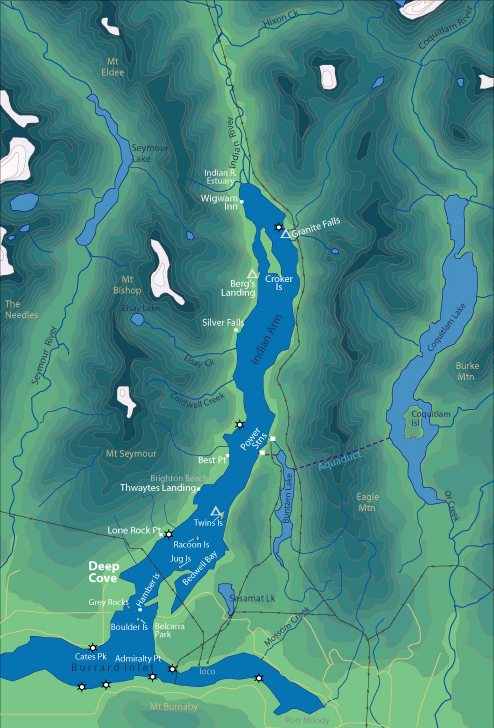
| World > North America > Canada > BC > Vancouver > Indian Arm | |||
|
[Back to Indian Arm Main Page]
Admiralty Point | Bedwell Bay |
Belcarra |
Best Point | Bishop |
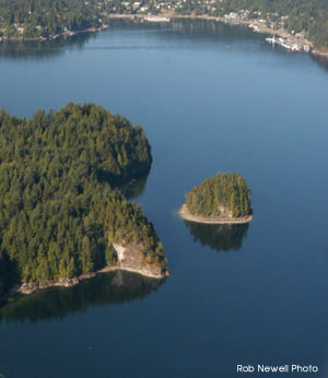
Jug Island Jug Island is one of the closest destinations to Deep Cove. Located adjacent to Jug Island is probably the best beach on Lower Indian Arm. It makes for a great place to hang out, swim and enjoy the view. Distance from Deep Cove: 2.75 km Paddling Time One Way: Fast: 30 min. Avg: 45 min. Leisurely: 1 hr Suggested Route: Leave Deep Cove on the south shore until shoreline rounds the corner heading south. From here cross Indian Arm Channel directly to east shore. Follow east shore north until you reach Jug Island. Hazards:
Features: Jug Island is difficult to access with a very steep shoreline. It is within a stones throw of the mainland. Adjacent to Jug Island is a beautiful, pebble beach, one of the few and perhaps the nicest beaches on Indian Arm. Jug Island Beach is a part of Belcarra Park. From here you can walk 30 - 40 min. via a hilly trail to the main part of Belcarra Park. There is an outhouse located near the trail head. Nature: Jug Island is difficult to access with a very steep shoreline. It is within a stones throw of the mainland. Adjacent to Jug Island is a beautiful, pebble beach, one of the few and perhaps the nicest beaches on Indian Arm. Jug Island Beach is a part of Belcarra Park. From here you can walk 30 - 40 min. via a hilly trail to the main part of Belcarra Park. There is an outhouse located near the trail head. History: At one time Jug Island had stone formations that resembled a jug handle, hence the name "Jug" Island. This arch fell off some time ago.
|
||
| Photos and information courtesy of
Deep Cove Canoe and Kayak Centre |
|||