|
|
|||
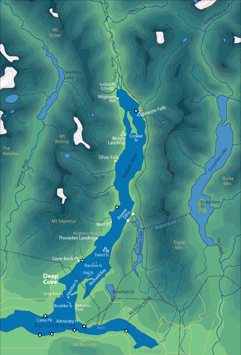
| World > North America > Canada > BC > Vancouver > Indian Arm | |||
|
[Back to Indian Arm Main Page]
Admiralty Point | Bedwell Bay |
Belcarra |
Best Point | Bishop |
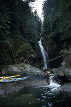
Silver Falls Silver Falls is located about two thirds of the way up Indian Arm. Tucked away in a nook of the steep shore line it can be easily missed. The Tsleil Waututh Nation (People of the Inlet) believe that it is not appropriate to look at Silver Falls. Distance from Deep Cove: 12 km Paddling Time One Way: Fast: 2 hrs. Avg: 3 hrs Leisurely: 4 hrs Suggested Route: Paddle the west shore of Indian Arm. Hazards:
|
||
| Photos and information courtesy of
Deep Cove Canoe and Kayak Centre |
|||