|
|
|||
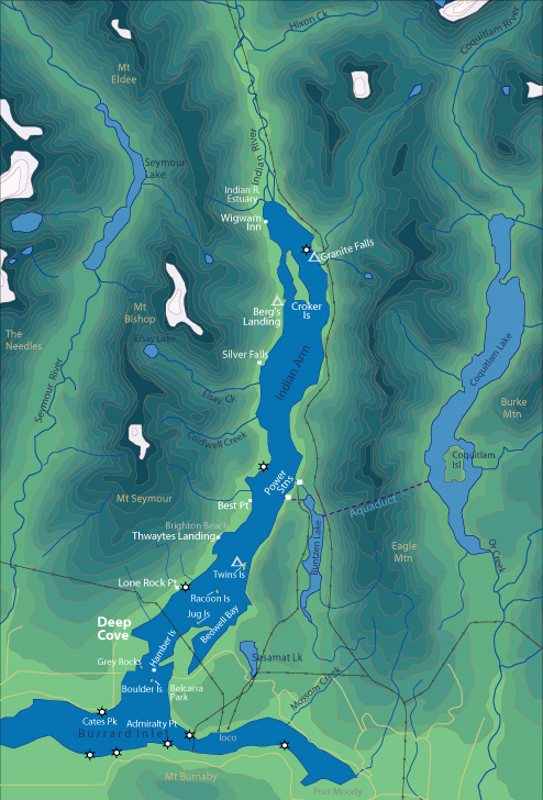
| World > North America > Canada > BC > Vancouver > Indian Arm | |||
|
[Back to Indian Arm Main Page]
Admiralty Point | Bedwell Bay |
Belcarra |
Best Point
| Bishop |
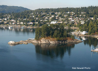
Grey Rocks A safe bet for a windy day. On most days you will paddle into the wind to reach Grey Rocks, making for an easier trip home. Distance from Deep Cove: 3 km Paddling Time One Way: Fast: 20 min. Avg: 30 min. Leisurely: 40 min. Suggested Route: Paddle south (right hand side) from Deep Cove along the west shore of Indian Arm. You can't miss it. Hazards:
Features: Grey Rocks Island is a very small privately owned Island with a beautiful house located on it. Grey Rocks is located in the middle of Strathcona Bay. There is a little park located on the mainland in between all the homes, in the very corner of Strathcona Bay. Nature:
There is an interesting rocky shoal on
the south-east side of Grey Rocks. This is inter-tidal, making for a great place
to observe underwater marine life, such as crabs, and sea
stars. |
||
| Photos and information courtesy of
Deep Cove Canoe and Kayak Centre |
|||