|
|
|||
| World > North America > Canada > BC > Vancouver > Indian Arm | |||
|
[Back to Indian Arm Main Page]
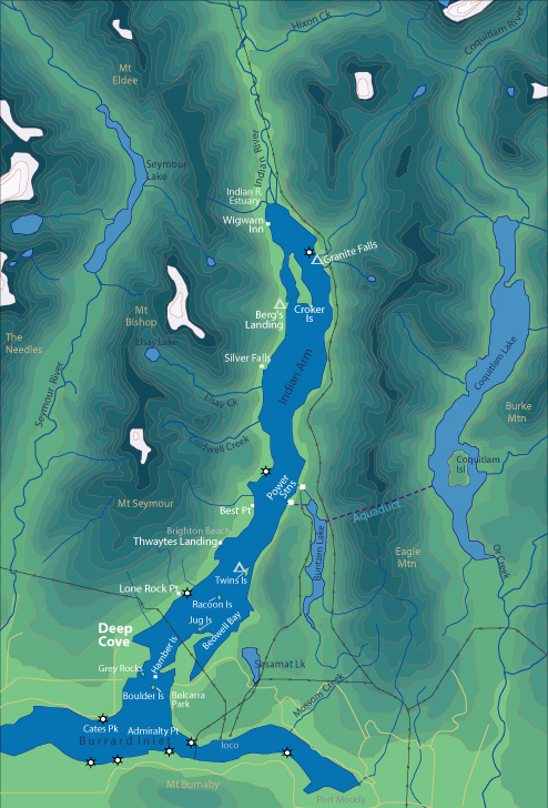
Admiralty Point | Bedwell Bay |
Belcarra |
Best Point | Bishop |
Land ownership Much of the shoreline of Indian Arm is privately owned. Technically, nobody can own below the high tide line. For this reason, you can land on the beaches below this point. However, it is important to respect people's property, and we do not encourage you to land in front of people's homes. Obviously, in an emergency situation nobody would refuse you the right to land on their beach. There are 5 locations in Southern Indian Arm where you can land, and 2 in the Northern part of Indian Arm. South Arm
North Arm
Thwaytes Landing is a 130 acre parcel of land that is up for sale, and The Nature Conservancy of BC is fundraising and negotiating with local governments to purchase this property. It has excellent recreational value, and because of its great location and the limited landing beaches on Indian Arm it would be a prime asset for boaters of all types. |
||
| Photos and information courtesy of
Deep Cove Canoe and Kayak Centre |
|||